
Tropical Storm Maymay Brings Rains and Storm-Force Winds
Signal No. 2 raised in La Union as storm moves toward afternoon landfall
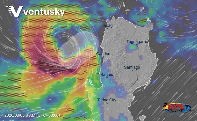
Animated Screenshot courtesy of Ventusky
PAGASA reports, Tropical Storm Maymay (International Name: KUJIRA) was tracked 170 kilometers west of Bacnotan, La Union as of 5:00 AM on August 5, 2026. The storm carries maximum sustained winds of 65 km/h near the center, with gusts reaching up to 80 km/h, and is moving slowly southeastward.
Tropical Storm Maymay has intensified over the West Philippine Sea and is forecast to make landfall in Northern Luzon on Wednesday afternoon or evening.
PAGASA placed several provinces in northern Luzon under stormy conditions, warning local communities against potential flash floods, landslides, and structural wind damage due to moderate to heavy and at times intense rainfall.
Municipalities in La Union currently under Signal No. 2 include:
- Luna, Caba, Santol, Bauang, and the City of San Fernando
- San Juan, Bagulin, Aringay, Bangar, and San Gabriel
- Burgos, Naguilian, Bacnotan, Sudipen, and Balaoan
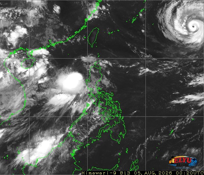
Source: Japan Meteorological Agency
Provinces directly affected by stormy conditions from Tropical Storm Maymay include:
- La Union
- Ilocos Sur
- Pangasinan
- Benguet
- Mountain Province
- Abra
PAGASA reports that coastal waters across extreme Northern Luzon and Central Luzon will experience moderate to rough sea conditions, with wave heights ranging from 1.2 to 3.0 meters. Nearby regions, including Cagayan Valley, Zambales, Tarlac, and Nueva Ecija, are experiencing rains accompanied by gusty winds.
Meanwhile, Typhoon Dolphin continues to move westward at 20 km/h outside the Philippine Area of Responsibility, located 1,845 kilometers east-northeast of extreme Northern Luzon with maximum sustained winds of 165 km/h.
SOURCE: PAGASA