
Isolated Rainshowers Expected Nationwide Due to Localized Thunderstorms
La Union and rest of Luzon face isolated thunderstorms with slight to moderate coastal seas
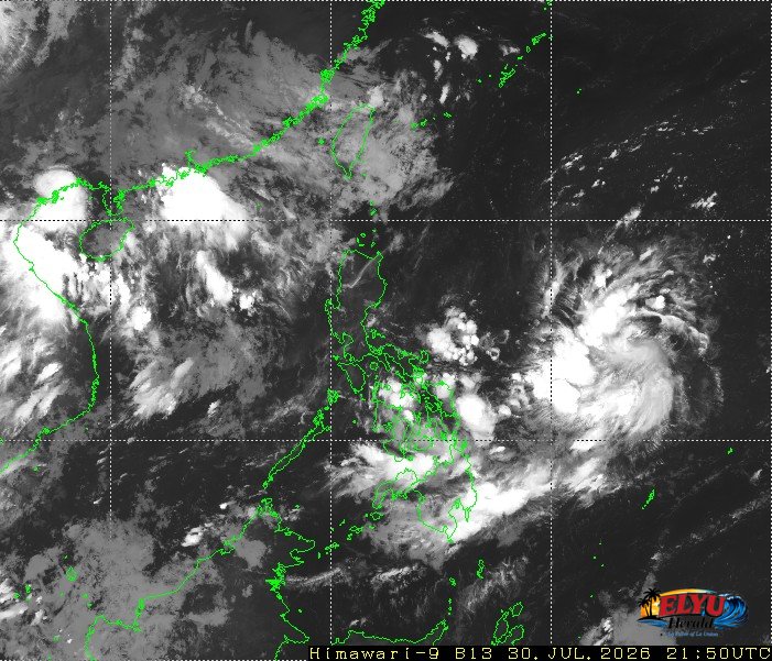
Source: Meteorological Satellite Center of JMA website
Localized thunderstorms will bring partly cloudy to cloudy skies with isolated rainshowers across Metro Manila and the rest of the country on Friday, July 31 says PAGASA. The official weather bulletin issued at 4:00 AM today, indicated that severe weather conditions could trigger localized flash floods or landslides in affected regions.
In La Union and neighboring provinces in Luzon, light to moderate winds will blow from the east to southeast. Coastal waters along coastal towns like Agoo, Aringay, Caba, Bauang, San Fernando, San Juan, Bacnotan, Balaoan, Luna, and Bangar will remain slight to moderate, with wave heights measuring between 0.6 to 1.2 meters.
While the trough of a Low Pressure Area continues to affect Visayas and Mindanao, weather conditions across northern and central Luzon will remain largely driven by localized cloud formations. Looks like clear skies for most of the day in the Surfing Capital of the North!
Key forecast details for Luzon include:
- General Weather: Partly cloudy to cloudy skies with localized rainshowers or short thunderstorms.
- Wind Conditions: Light to moderate speeds coming from the east to southeast direction.
- Coastal Waters: Slight to moderate wave conditions reaching maximum heights of 1.2 meters.
Atmospheric measurements recorded at the main PAGASA Science Garden station in Diliman, Quezon City showed a maximum temperature of 32.7 °C at 2:00 PM yesterday and a minimum temperature of 23.5 °C at 5:00 AM. Relative humidity peaked at 96 percent during the early morning hours.
SOURCE: PAGASA