
Tropical Depression Luis Accelerates Over Coastal Isabela
La Union coastal waters face two-meter waves as monsoon brings strong gusts
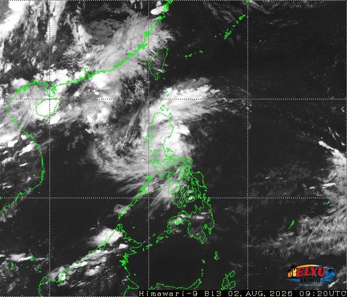
Satellite Screenshot Source: Meteorological Satellite Center of JMA website
Tropical Depression Luis slightly accelerated while moving northwestward at 20 km/h over the coastal waters of Divilacan, Isabela, on Monday afternoon, August 3. The weather system maintains maximum sustained winds of 45 km/h near the center and gustiness reaching up to 60 km/h, says PAGASA.
While Tropical Cyclone Wind Signal No. 1 remains in effect for eastern portions of Northern Luzon, the storm combined with the Southwest Monsoon is generating rougher conditions across the broader region.
In La Union, as well as neighboring Ilocos provinces, PAGASA reported forecast wave heights reaching up to 2.0 meters along local seaboards. Operators of motorbancas and small vessels in coastal towns like San Juan, Bauang, and San Fernando are advised to exercise caution or avoid navigating under these conditions.
Key weather advisories and track details include:
- Strong to gale-force gusts affecting coastal and elevated areas across most of Luzon and the Visayas through Tuesday, August 4.
- Signal No. 1 active in parts of Cagayan, Isabela, Quirino, Apayao, Kalinga, Mountain Province, Ifugao, and Aurora.
- Rough seas up to 3.0 meters along the western seaboard of Pangasinan, where small seacraft are advised not to venture out.
The storm is expected to move northwestward and may pass close to Cagayan or Isabela before making a sharp turn toward the east-northeast away from land. PAGASA forecasts that the weather system will downgrade into a remnant low by Wednesday, August 5.
SOURCE: PAGASA