
Localized Thunderstorms to Bring Scattered Rains Across Luzon
La Union residents and fishermen face isolated rainshowers and moderate to rough coastal waters.
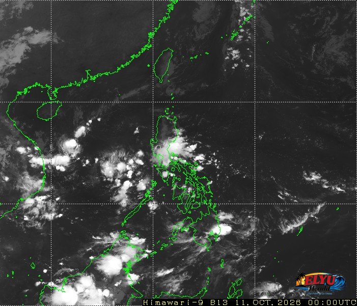
Screenshot courtesy of JMA
PAGASA says, localized thunderstorms will bring partly cloudy to cloudy skies with isolated rainshowers across Northern Luzon and other parts of the island today, October 11, 2026. PAGASA released its official bulletin at 4:00 AM, advising the public to monitor changing weather conditions.
In La Union and neighboring provinces, severe thunderstorms could trigger sudden flash floods or landslides in low-lying and mountainous areas. Coastal communities in towns such as San Fernando, San Juan, and Bauang can expect moderate to rough sea conditions. Prevailing winds from the northeast to east will range from moderate to strong, generating wave heights between 1.5 and 2.8 meters.
PAGASA identified four distinct weather mechanisms currently affecting the country:
- Northeasterly Windflow: Bringing cloudy skies and rains to Batanes.
- Easterlies: Causing scattered rains and thunderstorms over Metro Manila, CALABARZON, Aurora, Nueva Ecija, Bulacan, and parts of Cagayan Valley.
- Intertropical Convergence Zone (ITCZ): Driving scattered rainfall across Southern Luzon, Visayas, and Mindanao.
- Localized Thunderstorms: Bringing isolated rainshowers to the rest of Luzon.
Outside the Philippine Area of Responsibility (PAR), state meteorologists are tracking two weather systems. Typhoon Koguma was recorded 2,795 kilometers east-northeast of Extreme Northern Luzon with maximum sustained winds of 175 km/h and gusts up to 215 km/h. A separate tropical depression was located 2,940 kilometers east of Southern Luzon with maximum sustained winds of 45 km/h moving east-northeastward at 20 km/h.
SOURCE: PAGASA