
Habagat Still Brings Rain Across Luzon
Cloudy skies and scattered thunderstorms to be experienced throughout the day.
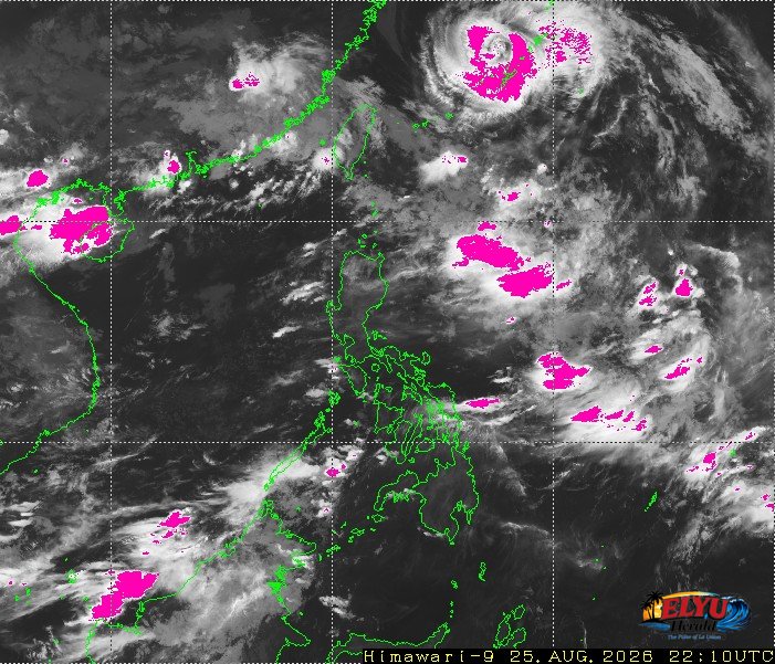
Screenshot courtesy of JMA
The Habagat is currently affecting Luzon, bringing cloudy skies with scattered rains and thunderstorms to multiple regions on August 26, 2026, PAGASA reports. An advisory issued at 4:00 AM said, the Habagat may still cause moderate to heavy rains and trigger flash floods or landslides in low-lying and mountainous areas.
La Union residents can expect cloudy skies with scattered rains and thunderstorms throughout the day. Temperatures will range from 25°C to 30°C, accompanied by moderate to strong winds blowing from the southwest.
While the broader region experiences monsoon rains, PAGASA issued a specific rainfall advisory for neighboring areas, warning of heavy rains within the next two to three hours in:
- Pangasinan (including Bolinao, Alaminos, and Agno)
- Ilocos Norte (including Pagudpud, Pasuquin, and Vintar)
- Batanes, Cagayan, and parts of Nueva Vizcaya
Moderate to strong winds blowing from the southwest will generate waves reaching heights of 1.5 to 3.4 meters along the seaboards of Luzon. Fishermen and small sea vessels in Bauang, San Fernando City and San Juan are advised to take precautionary measures due to these rough sea conditions. Meanwhile, the rest of the country will experience lighter winds and calmer seas with wave heights ranging from 0.6 to 2.1 meters.
SOURCE: PAGASA