
Habagat + 3 Storm Systems Continuously Bring Rains and Rough Seas
La Union face scattered rains and rough coastal waters amidst multiple weather disturbances.
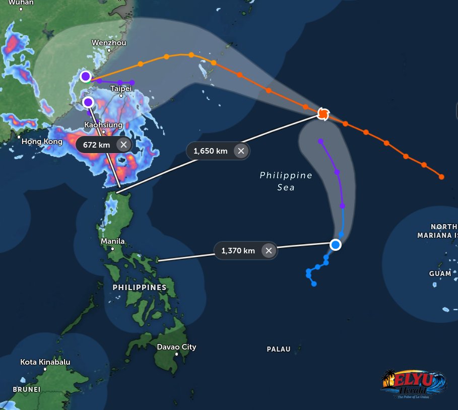
Screenshot courtesy of Zoom.Earth
PAGASA reported at 5:00 AM on August 24, 2026, that the HABAGAT is currently bringing scattered rains, thunderstorms, and strong winds across Northern Luzon.
La Union residents are advised to prepare for light to moderate, and at times heavy, rainfall expected to fall within the next few hours.
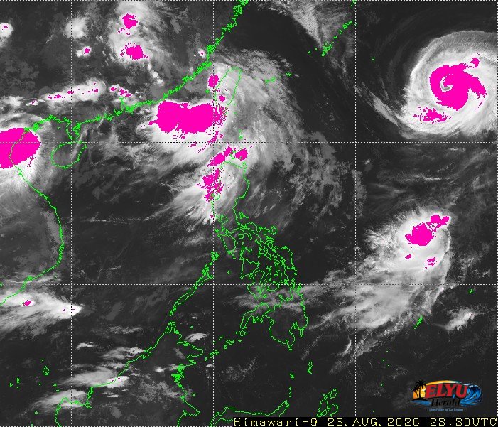 Source: Japan Meteorological Agency
While the monsoon drives the current weather, three tropical cyclones remain active outside the Philippine Area of Responsibility (PAR):
- Typhoon Saudel (2618) is located 1,660 kilometers east-northeast of Extreme Northern Luzon, packing maximum sustained winds of 175 km/h and gusts up to 215 km/h. It continues to move west-northwestward at 30 km/h away from the Philippine landmass.
- An unnamed Tropical Depression (formerly Neneng) is moving north-northeastward at 10 km/h, located 1,330 kilometers east of Southeastern Luzon.
- Tropical Depression Gaenari (2620) is situated 520 kilometers north of Itbayat, Batanes, carrying winds of 55 km/h.
La Union sea conditions are highly unfavorable for small vessels. PAGASA warns that winds blowing from the southwest will be moderate to strong, causing moderate to rough coastal waters with wave heights reaching 1.5 to 3.4 meters. Local disaster risk reduction and management offices are actively monitoring mountain slopes and low-lying areas for potential hazards.
PAGASA highlighted several key areas affected by the monsoon:
- Yellow rainfall warnings in Abra, Ilocos Sur, and Batanes.
- Light to heavy rains in Pangasinan, Benguet, and Apayao.
- Coastal conditions across Northern Luzon remain rough, with southwest winds persisting throughout the day.
SOURCE: PAGASA