
2 Storm Systems Outside PAR
La Union coastal towns brace for moderate to heavy rains and rough ocean waves from HABAGAT.
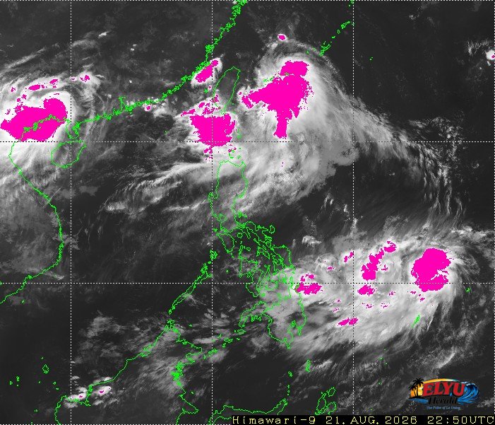
Screenshot courtesy of JMA
PAGASA reports in its 5:00 AM advisory on August 22, 2026, the Southwest Monsoon is expected to dump light to heavy rains across Northern Luzon.
Moderate to strong winds blowing from the southwest will affect the coastal waters of the Ilocos Region. Coastal conditions are expected to range from moderate to rough, posing potential risks for small seacraft.
Residents across La Union, particularly in coastal municipalities like Agoo, Aringay, Caba, Bauang, San Fernando, San Juan, Bacnotan, Luna and Balaoan, should prepare for moderate to heavy rainfall throughout the day.
Maritime conditions are forecasted as follows:
- Moderate to strong winds blowing from the southwest.
- Moderate to rough coastal waters with wave heights ranging from 1.5 to 3.4 meters.
- Scattered thunderstorms that can suddenly reduce visibility at sea.
Two weather disturbances are being monitored outside the Philippine Area of Responsibility (PAR). Typhoon Saudel was located 2,710 kilometers east of Northern Luzon with maximum sustained winds of 130 kilometers per hour, while an unnamed tropical depression was spotted 1,195 kilometers east of Northeastern Mindanao with winds of 45 kilometers per hour.
SOURCE: PAGASA