
Tropical Depression Kiyapo Forms East of Central Luzon
PAGASA monitors TD Kiyapo as La Union prepares for localized thunderstorms.
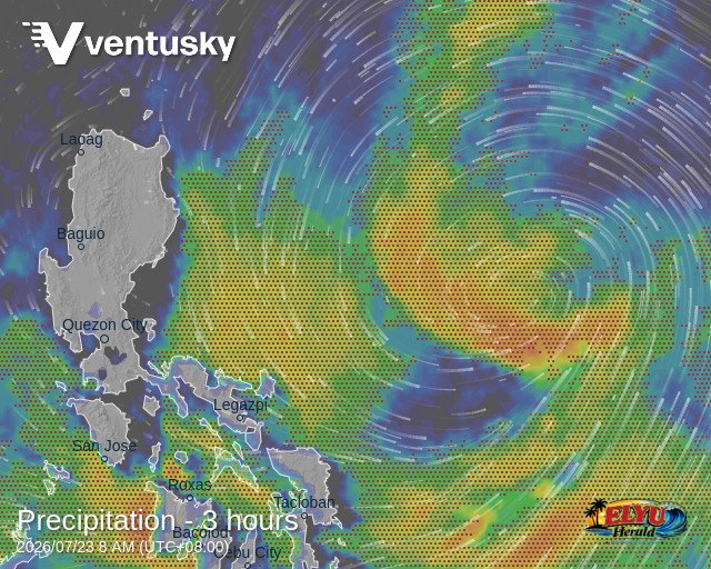
Screenshot courtesy of Ventusky
According to PAGASA, Tropical Depression Kiyapo was located 960 kilometers east of Central Luzon at 3:00 AM on July 23, 2026. The weather disturbance carries maximum sustained winds of 45 km/h near the center and gusts of up to 55 km/h, moving west-northwest at 20 km/h.
While the tropical depression’s extension affects eastern sections of the country, La Union and the rest of Northern Luzon are projected to experience partly cloudy to cloudy skies with isolated rainshowers or thunderstorms caused by localized weather activity. Coastal waters along the province’s seaboard will remain slight to moderate, with wave heights ranging between 0.6 and 1.2 meters.
The state weather bureau issued the following weather forecasts across affected regions:
- Bicol Region, Eastern Visayas, and Romblon: Cloudy skies with scattered rains and thunderstorms due to the trough of Tropical Depression Kiyapo.
- Mindanao, Visayas, Occidental Mindoro, and Palawan: Moderate to heavy rains caused by the Southwest Monsoon.
- Metro Manila and the rest of Luzon: Isolated rainshowers due to localized thunderstorms, with possible flash floods or landslides during severe downpours.
Winds across Northern Luzon will remain light to moderate, blowing from the northeast to north. Local disaster authorities advise residents in low-lying and mountainous areas to monitor short-duration heavy rain and stay alert for potential localized flooding.
SOURCE: PAGASA