
Typhoon Inday Moves Near Batanes
TS Inday to cause scattered rains and potential flash floods in La Union and parts of Ilocos.
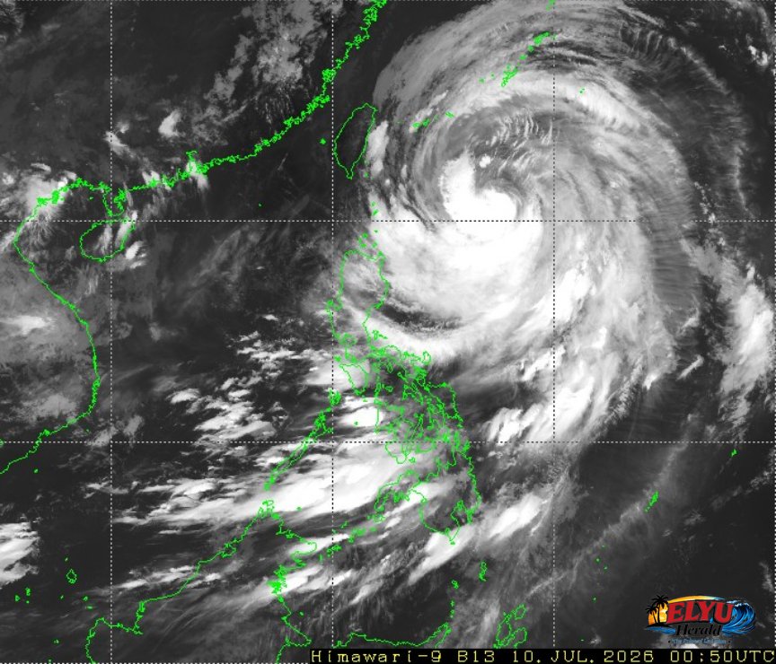
Screenshot of Himawari-9 viewer, credit Meteorological Satellite Center / Japan Meteorological Agency (JMA)
According to PAGASA, Typhoon Inday was located 640 kilometers east of Basco, Batanes at 3:00 AM today, packing maximum sustained winds of 150 kilometers per hour and gusts of up to 185 kilometers per hour. The storm has weakened a little since yesterday and is currently moving northwestward at 20 kilometers per hour, bringing stormy weather, rains, and gusty winds to northern Luzon.
While Batanes and far northern Luzon face the direct impact of the storm, the outer bands of the typhoon will affect the Ilocos Region, including La Union. The province is expected to experience cloudy skies with scattered rains and thunderstorms.
Local authorities warn that these weather conditions could lead to hazardous situations in vulnerable areas. The key details of the weather advisory include:
- La Union and the rest of the Ilocos Region face risks of flash floods and landslides due to moderate to heavy rains.
- The Southwest Monsoon is also active, bringing occasional rains to parts of Southern Luzon, Visayas, and Mindanao.
- Coastal waters surrounding Luzon will remain moderate, with wave heights ranging from 1.2 to 2.5 meters, requiring caution for small seacraft.
Residents in low-lying and mountainous areas of La Union are advised to stay alert for sudden changes in weather. PAGASA will continue to monitor the typhoon’s movement as it tracks northwestward.
SOURCE: PAGASA