
Super Typhoon Bavi Tracks West-Northwest Outside Philippine Boundary
La Union braces for localized thunderstorms as Super Typhoon Bavi moves outside PAR
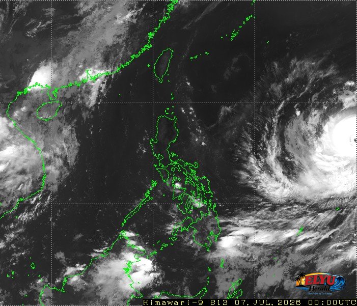
Screenshot of Himawari-9 viewer, credit Meteorological Satellite Center / Japan Meteorological Agency (JMA)
According to PAGASA in its daily weather forecast issued at 4:00 AM on July 7, 2026, Super Typhoon Bavi (2609) remains outside the Philippine Area of Responsibility (PAR) at 2,010 kilometers east of Central Luzon. It has moved 345 kilometers closer since yesterday. The storm is moving west-northwestward at 30 kilometers per hour, carrying maximum sustained winds of 195 kilometers per hour and gusts of up to 240 kilometers per hour. While the typhoon does not directly affect the country yet, localized thunderstorms will bring isolated rainshowers across various regions.
In La Union and the surrounding provinces in Northern Luzon, residents can expect partly cloudy to cloudy skies. Localized thunderstorms may cause sudden, heavy downpours, presenting risks of flash floods or landslides in vulnerable areas.
For coastal communities and local fisherfolk in Bauang, San Fernando, San Juan, Bacnotan and Balaoan, PAGASA outlined the following forecast conditions for Northern Luzon:
- Wind speed: Light to moderate.
- Wind direction: East to southeast.
- Coastal waters: Slight to moderate, with wave heights measuring between 0.6 and 2.1 meters.
Additionally, the easterlies—warm winds blowing from the Pacific Ocean—are currently affecting the eastern sections of Northern and Central Luzon. PAGASA continues to track the movement of the super typhoon and urges the public to monitor official updates for any changes in the weather pattern.
SOURCE: PAGASA