
Super Typhoon Bavi Remains Outside Philippine Boundary
La Union will experience localized thunderstorms and scattered rainshowers.
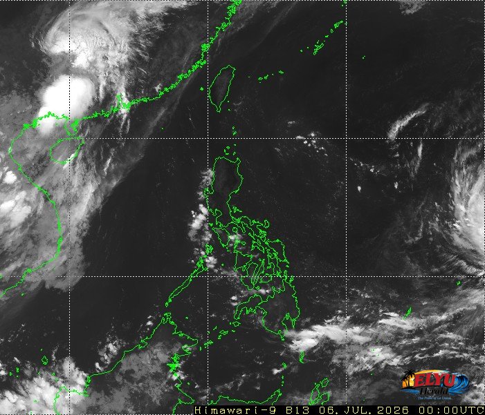
Screenshot of Himawari-9 viewer, credit Meteorological Satellite Center / Japan Meteorological Agency (JMA)
According to PAGASA in its July 6, 2026 bulletin, Super Typhoon Bavi (International Name) continues to move west-northwestward outside the Philippine Area of Responsibility (PAR) at 15 kilometers per hour. As of 3:00 AM today, the storm was located 2,355 kilometers east of Southeastern Luzon, packing maximum sustained winds of 215 kilometers per hour and gusts of up to 265 kilometers per hour. The weather bureau stated that the typhoon currently has no direct impact on the country, though localized thunderstorms will bring scattered rains.
In La Union and the rest of the Ilocos Region, residents can expect partly cloudy to cloudy skies with isolated rain showers or thunderstorms. Local disaster risk reduction offices in towns like San Fernando, San Juan, and Bauang advise the public to remain alert against possible flash floods or landslides during severe thunderstorms.
For coastal communities and local fisherfolk in La Union, PAGASA reported the following marine and wind conditions for Northern Luzon:
- Wind speed: Light to moderate
- Wind direction: Northeast to Southeast
- Coastal waters: Slight to moderate, with wave heights ranging from 0.6 to 1.5 meters
Additionally, an area of high pressure is currently extending over extreme Northern Luzon, bringing generally fair weather in the afternoon. PAGASA will continue to monitor the track of Super Typhoon Bavi as it moves across the Pacific Ocean.
SOURCE: PAGASA