
Tropical Storm Henry Moves Westward Outside Philippine Territory
La Union residents advised to prepare for isolated thunderstorms and moderate coastal waves
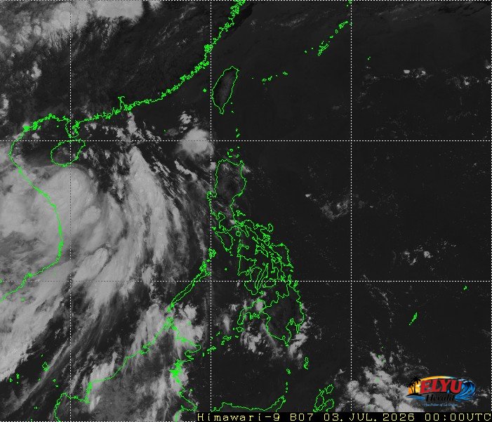
Screenshot of Himawari-9 viewer, credit Meteorological Satellite Center / Japan Meteorological Agency (JMA)
According to PAGASA in its 4:00 AM bulletin on July 3, 2026, Tropical Storm Henry (International name: Maysak) was located 1,095 kilometers west of Northern Luzon, moving west-southwestward at 15 kilometers per hour outside the Philippine Area of Responsibility. It has almost doubled its distance from yesterday’s report of 610 kilometers. The storm maintains maximum sustained winds of 60 kilometers per hour near the center and gustiness of up to 80 kilometers per hour, bringing localized thunderstorms to the rest of the country.
While the storm remains outside local boundaries, La Union and the rest of the Ilocos Region will still experience partly cloudy to cloudy skies, much like it was experienced yesterday. Localized thunderstorms may bring sudden, isolated rainshowers to coastal towns such as San Juan, Bauang, and the city of San Fernando.
PAGASA has warned that severe thunderstorms could trigger sudden flash floods or landslides in low-lying and mountainous areas like San Gabriel. Residents are urged to monitor local weather updates and take necessary precautions during heavy downpours.
Coastal conditions in coastal areas like Agoo, Caba, Bauang, San Fernando, San Juan, Bacnotan and Balaoan in La Union and the rest of Luzon will remain relatively safe but cautious for small vessels. Winds will blow light to moderate from the east to southeast, generating slight to moderate coastal waters with wave heights ranging from 0.6 to 2.1 meters.
Meanwhile, the easterlies—or warm winds blowing from the Pacific Ocean—are currently affecting the eastern sections of Central Luzon, Southern Luzon, and Visayas, bringing similar isolated rainshowers to those areas.
SOURCE: PAGASA