
Tropical Depression Henry Moves Westward Outside Philippine Boundary
The storm is spotted west of Bacnotan, La Union, as it tracks away over the West Philippine Sea.
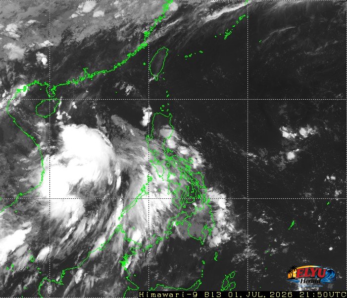
Screenshot of Himawari-9 viewer, credit Meteorological Satellite Center / Japan Meteorological Agency (JMA)
According to PAGASA, Tropical Depression Henry was located outside the Philippine Area of Responsibility on July 2, 2026, moving west-northwestward at 25 kilometers per hour. The storm, which is no longer directly affecting the country, maintains maximum sustained winds of 55 kilometers per hour near the center and gustiness of up to 70 kilometers per hour.
Weather satellite data placed the center of the tropical depression at 610 kilometers west of Bacnotan, La Union as of 3:00 AM. Although the storm is outside the local weather boundary, its distance from the coast of La Union means the province will not experience direct heavy rainfall from the storm’s center.
However, the Southwest Monsoon continues to affect the western sections of Southern Luzon, Visayas, and Mindanao. PAGASA warned that this weather system will bring cloudy skies with scattered rains and thunderstorms to Palawan and Occidental Mindoro, raising risks of flash floods or landslides.
For coastal areas, the western section of Luzon will experience moderate to strong winds blowing from the southwest to southeast. This will result in moderate to rough coastal waters with wave heights ranging from 1.2 to 2.5 meters, requiring caution for small sea vessels.
Meanwhile, Metro Manila and the rest of the country will have partly cloudy to cloudy skies with isolated rainshowers or thunderstorms due to localized thunderstorms. Yesterday, the PAGASA Weather Station in Diliman, Quezon City recorded a maximum temperature of 33.2 degrees Celsius at 1:00 PM and a minimum of 24.8 degrees Celsius at 6:00 AM.
SOURCE: PAGASA