
Tropical Depression Henry Brings Rains Across Luzon
The storm moves northwestward near Bataan, triggering rain warnings in several provinces
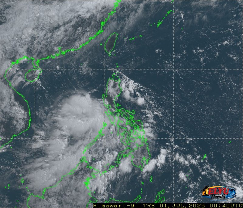
Screenshot of Himawari-9 viewer, credit Meteorological Satellite Center / Japan Meteorological Agency (JMA)
According to PAGASA in its 4:00 AM bulletin on July 1, 2026, Tropical Depression Henry has maintained its strength as it moves northwestward at 25 kilometers per hour off the coast of Bataan, bringing moderate to heavy rains and gusty winds to western Luzon. At 3:00 AM today, the center of the storm was located 70 kilometers west-southwest of Abucay, Bataan, packing maximum sustained winds of 45 kilometers per hour near the center and gusts of up to 55 kilometers per hour.
The state weather bureau warned that Zambales and Bataan will experience direct rains with gusty winds. Residents in these areas face potential flash floods or landslides due to the continuous moderate to heavy rainfall.
Meanwhile, Metro Manila, CALABARZON, Bulacan, Tarlac, Pampanga, Oriental Mindoro, Occidental Mindoro, and Marinduque will experience cloudy skies with scattered rains and thunderstorms. PAGASA stated that these conditions may also trigger flash floods or landslides during heavy downpours.
The southwest monsoon is also affecting the western sections of Southern Luzon, Visayas, and Mindanao. This weather system will bring scattered rains and thunderstorms to the Western Visayas, Negros Island Region, Central Visayas, and parts of Mindanao, while the rest of the country can expect isolated rainshowers.
Coastal waters along the western section of Luzon will be moderate to rough, with wave heights reaching up to 2.8 meters. The rest of the country’s seaboards will remain slight to moderate, requiring caution for small sea vessels.
SOURCE: PAGASA