
Typhoon Francisco Prompts Rain Warnings Across Northern Luzon
PAGASA monitors Typhoon Francisco exit and incoming Tropical Storm Higos.
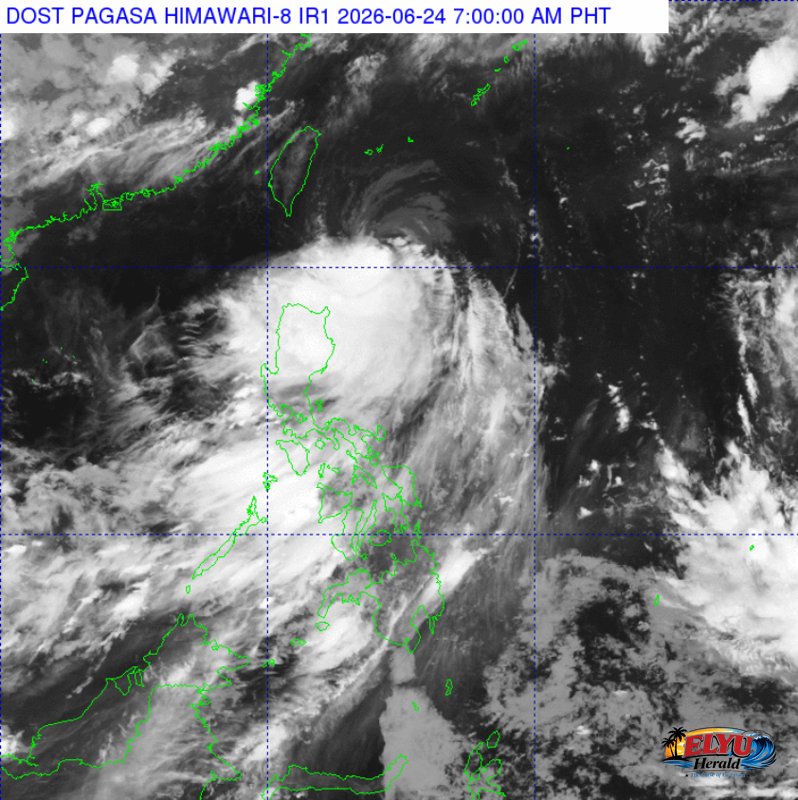
Screenshot from PAGASA's Himawari-8 viewer, credit DOST-PAGASA
According to PAGASA in its weather bulletin issued at 4:00 AM on June 24, 2026, Typhoon Francisco (international name Mekkhala) has maintained its strength off Northern Luzon, threatening Batanes, the Babuyan Islands, and the Ilocos Region with heavy rains and strong winds. The storm was located 275 kilometers east of Basco, Batanes, packing maximum sustained winds of 155 kilometers per hour and gusts of up to 190 kilometers per hour while moving northward at 10 kilometers per hour.
PAGASA warned that Batanes and the Babuyan Islands will experience rains with gusty winds, posing a minor threat to lives and property. Meanwhile, the Ilocos Region, Cordillera Administrative Region, and the rest of Cagayan Valley will face cloudy skies with scattered rains and thunderstorms. Residents in these areas are advised to prepare for possible flash floods or landslides due to moderate to heavy rainfall.
Additionally, the Southwest Monsoon continues to affect Central Luzon, Southern Luzon, and Western Visayas. This weather system will bring scattered rains and thunderstorms to Metro Manila, Central Luzon, CALABARZON, MIMAROPA, the Bicol Region, and the Negros Island Region.
PAGASA is also monitoring Tropical Storm Higos, which remains outside the Philippine Area of Responsibility at 2,285 kilometers east of Southeastern Luzon. Coastal waters along the northern and eastern sections of Northern Luzon will remain moderate to rough, with wave heights reaching up to 4.0 meters.
SOURCE: PAGASA