
Tropical Storm FRANCISCO Tracks Westward Outside Philippine Boundary
The storm's outer bands bring rain to parts of Visayas and Mindanao as easterlies affect Luzon.
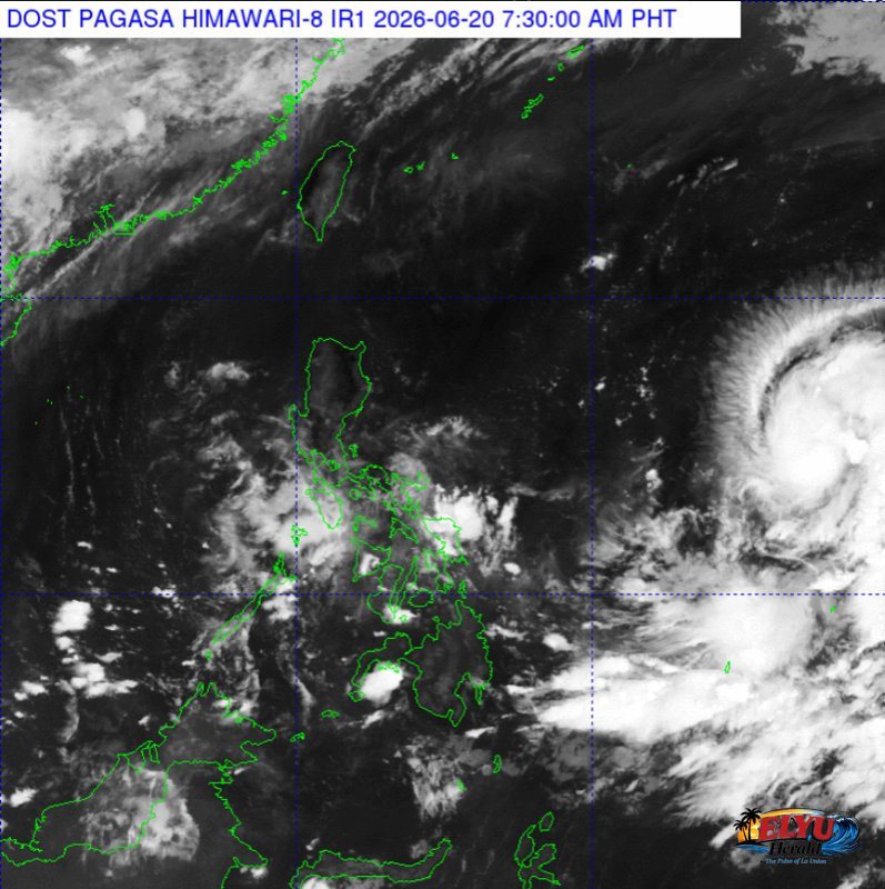
Screenshot from PAGASA's Himawari-8 viewer, credit DOST-PAGASA
According to PAGASA in its 4:00 AM advisory on June 20, 2026, Tropical Storm Francisco (International Name: Mekkhala) continues to move west-northwestward at 25 kilometers per hour outside the Philippine Area of Responsibility (PAR). The storm was last located 1,665 kilometers east of southeastern Luzon, carrying maximum sustained winds of 75 kilometers per hour and gustiness of up to 90 kilometers per hour.
Although the storm has not entered the country’s boundary, its trough, or the extension of the low-pressure area, is currently bringing cloudy skies with scattered rainshowers and thunderstorms to Eastern Samar, Southern Leyte, Dinagat Islands, and Surigao del Norte. Residents in these areas are advised to prepare for potential flash floods or landslides during periods of moderate to heavy rainfall.
Meanwhile, easterlies—warm winds blowing from the Pacific Ocean—are affecting Central and Southern Luzon. This weather system is bringing partly cloudy to cloudy skies with isolated rainshowers or thunderstorms to Metro Manila, Central Luzon, CALABARZON, MIMAROPA, and the Bicol Region.
The rest of the country will experience similar partly cloudy skies with isolated rainshowers due to localized thunderstorms. PAGASA warned that severe afternoon or evening thunderstorms nationwide could still trigger sudden flash floods or landslides in low-lying or mountainous areas.
Coastal water conditions across the archipelago remain safe for maritime activities. Winds across Luzon, Visayas, and Mindanao will blow at light to moderate speeds, resulting in slight to moderate sea conditions with wave heights peaking at 1.5 meters.
SOURCE: PAGASA