
Typhoon Inday weakens but brings heavy rains and gusty winds across North Luzon
Farmers in La Union urged to secure crops as typhoon passes near Northern Luzon with Southwest Monsoon
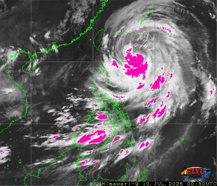
Screenshot of Himawari-9 viewer, credit Meteorological Satellite Center / Japan Meteorological Agency (JMA)
According to PAGASA, Typhoon Inday has weakened from a super typhoon to a typhoon but continues to bring heavy rains and gusty winds across major parts of the Philippines as of 3:00 AM on July 10, 2026. The storm’s center is located 640 km east of Basco, Batanes, with maximum sustained winds of 150 km/h and gustiness up to 185 km/h, moving northwestward at 20 km/h.
The typhoon, combined with the enhanced Southwest Monsoon (habagat), is expected to affect:
- Cagayan Valley, Cordillera Administrative Region, Ilocos Norte, Aurora, and Catanduanes with rains and gusty winds
- Eastern Visayas and Bicol Region with scattered rains and thunderstorms
- MIMAROPA, Western Visayas, Negros Island Region, and Mindanao with occasional to scattered rainshowers
Farmers in La Union, including towns like San Fernando, San Juan, Bacnotan, San Gabriel and Bauang, are advised to:
- Inspect crops for flooding, waterlogging, pests, and disease
- Secure greenhouses, nurseries, and storage facilities against strong winds
- Avoid field operations during thunderstorms to prevent lightning hazards
- Check and repair irrigation, pumps, and drainage systems after heavy rains
- Prepare contingency plans for harvesting and post-harvest handling
El Niño is expected to develop by mid-2026, increasing the risk of dry spells and drought. Farmers should maintain irrigation, use drought-tolerant crops, and stay alert to daily weather updates from DOST-PAGASA.
SOURCE: PAGASA