
Super Typhoon Inday Intensifies, Moves West-Northwest
Northeastern Philipines braces for heavy rains and strong winds as Inday passes
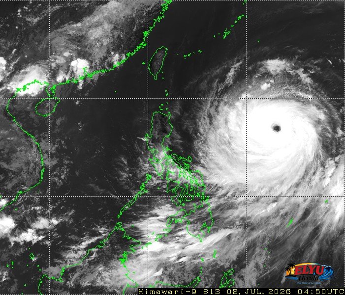
Screenshot of Himawari-9 viewer, credit Meteorological Satellite Center / Japan Meteorological Agency (JMA)
According to PAGASA, Super Typhoon Inday has intensified to a super typhoon with maximum sustained winds of 195 km/h and is moving west‑northwest over the Philippine Sea, threatening heavy rainfall and strong winds across the Philippines, especially in the northeastern portion of the Luzon.
The Ilocos Region, is expected to experience heavy rainfall and wind signals as the typhoon passes over the northern Luzon area. Residents should prepare for Wind Signal No. 2 or 3 and anticipate gale‑force gusts.
Key hazards and conditions:
- Heavy rainfall outlook for the entire country, with the most intense rains in the Ilocos Region.
- Wind signals: Wind Signal No. 1 in most areas today, with the possibility of signals No. 2 or 3 as Inday moves closer.
- Sea conditions: Rough seas up to 4.5 m along the eastern seaboards of Northern Luzon; mariners advised to remain in port or seek shelter.
PAGASA urges the public to monitor the latest severe weather bulletin every six hours, secure loose objects, and follow evacuation orders if issued by local officials.
SOURCE: PAGASA