
Typhoon Francisco Intensifies Over Philippine Sea
La Union and northern provinces brace for strong gusts as the typhoon enhances monsoon winds
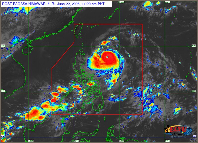
Screenshot from PAGASA's Himawari-8 viewer, credit DOST-PAGASA
According to PAGASA in its 11:00 AM bulletin on June 22, 2026, Typhoon Francisco has rapidly gained strength over the Philippine Sea and is moving west-northwest at 15 kilometers per hour. The storm is currently located 620 kilometers east of Tuguegarao City, Cagayan, carrying maximum sustained winds of 155 kilometers per hour and gusts of up to 190 kilometers per hour. While the typhoon is expected to remain far from the country’s landmass before exiting the Philippine Area of Responsibility on Friday, authorities have raised Tropical Cyclone Wind Signal No. 1 over Batanes and parts of Cagayan.
Although the typhoon will not make direct landfall, its outer winds and the enhanced Southwest Monsoon (Habagat) are bringing strong gusts to La Union and Pangasinan today. Local disaster risk reduction offices in La Union are monitoring coastal and upland communities, which are highly exposed to these strong winds. Residents living in houses made of light materials are advised to secure their properties to prevent minor wind damage.
The weather bureau noted that Typhoon Francisco will continue moving northwestward before turning north-northeast toward Japan’s Ryukyu Islands. Coastal waters in northern Luzon are experiencing moderate to rough seas, with waves reaching up to 3.5 meters in some eastern seaboards.
PAGASA advises operators of small sea vessels and motorbancas in northern Luzon to avoid venturing out to sea due to rough conditions. Local government units continue to monitor the weather situation to ensure public safety.
SOURCE: PAGASA