
Tropical Storm Outside PAR Intensifies and Heads Toward Northern Luzon
The storm is expected to enter the Philippine Area of Responsibility and become a typhoon
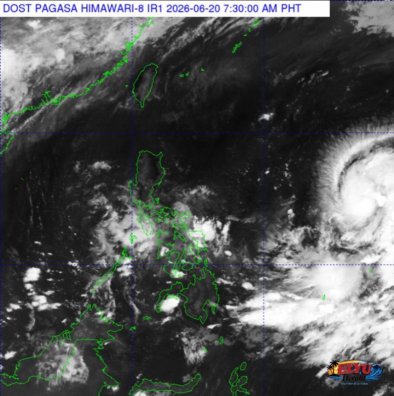
Screenshot from PAGASA's Himawari-8 viewer, credit DOST-PAGASA
According to PAGASA, a tropical storm located 1,675 kilometers east of Southeastern Luzon has intensified outside the Philippine Area of Responsibility (PAR) as of 10:00 PM on June 19, 2026. The storm is currently moving west-northwest at 25 kilometers per hour, packing maximum sustained winds of 65 kilometers per hour and gusts of up to 80 kilometers per hour. It is expected to enter the PAR between Saturday evening, June 20, and Sunday morning, June 21, where it will be given the local name Francisco.
Weather forecasters state that a direct landfall is currently unlikely. However, the storm is projected to steadily gain strength and could escalate into a typhoon by Sunday, June 21. Strong winds currently extend up to 280 kilometers outward from the center of the storm.
While the storm is unlikely to directly affect the country’s weather or coastal waters over the next three days, it may pass close to land by Tuesday, June 23, and Wednesday, June 24. Consequently, disaster officials may raise Wind Signal No. 1 over the northern and eastern portions of Northern Luzon as the storm approaches.
According to the forecast track, the storm will transition into a typhoon as it moves east of Central Luzon on Sunday morning. By Monday morning, June 22, the weather system is expected to be located approximately 695 kilometers east of Tuguegarao City, Cagayan, carrying winds of up to 150 kilometers per hour.
By Tuesday evening, the typhoon is projected to be 310 kilometers east-southeast of Basco, Batanes. PAGASA advises the public and local disaster risk reduction and management offices to continuously monitor weather updates, as the track of the storm may still change in succeeding bulletins.
SOURCE: PAGASA